


COAL GROVE A Voting District, Lawrence County, Ohio
About
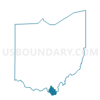
Outline

Summary
| Unique Area Identifier | 648472 |
| Name | COAL GROVE A Voting District |
| County | Lawrence County |
| State | Ohio |
| Area (square miles) | 0.42 |
| Land Area (square miles) | 0.34 |
| Water Area (square miles) | 0.07 |
| % of Land Area | 82.40 |
| % of Water Area | 17.60 |
| Latitude of the Internal Point | 38.49249690 |
| Longtitude of the Internal Point | -82.64715060 |
Maps


Graphs
Select a template below for downloading or customizing gragh for COAL GROVE A Voting District, Lawrence County, Ohio


Neighbors
Neighoring Voting District (by Name) Neighboring Voting District on the Map
- COAL GROVE B Voting District, Lawrence County, OH
- COAL GROVE C Voting District, Lawrence County, OH
- IRONTON 4D Voting District, Lawrence County, OH
- IRONTON 4G Voting District, Lawrence County, OH
- PERRY 1 Voting District, Lawrence County, OH
Top 10 Neighboring County Subdivision (by Population) Neighboring County Subdivision on the Map
- Ashland CCD, Boyd County, KY (27,229)
- Upper township, Lawrence County, OH (15,418)
- Perry township, Lawrence County, OH (6,973)
Top 10 Neighboring Place (by Population) Neighboring Place on the Map
Top 10 Neighboring Unified School District (by Population) Neighboring Unified School District on the Map
- Ashland Independent School District, KY (21,761)
- Ironton City School District, OH (11,031)
- Dawson-Bryant Local School District, OH (6,461)
Top 10 Neighboring State Legislative District Lower Chamber (by Population) Neighboring State Legislative District Lower Chamber on the Map
Top 10 Neighboring State Legislative District Upper Chamber (by Population) Neighboring State Legislative District Upper Chamber on the Map
Top 10 Neighboring 111th Congressional District (by Population) Neighboring 111th Congressional District on the Map
Top 10 Neighboring Census Tract (by Population) Neighboring Census Tract on the Map
- Census Tract 510.02, Lawrence County, OH (4,483)
- Census Tract 501, Lawrence County, OH (2,509)
- Census Tract 509, Lawrence County, OH (2,361)
- Census Tract 302, Boyd County, KY (1,381)